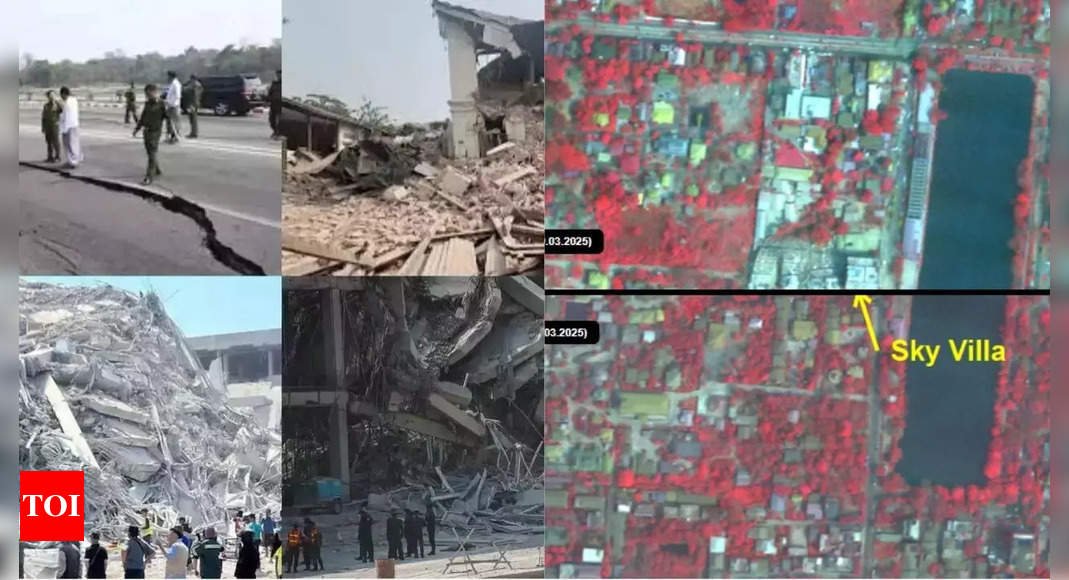
Natural catastrophes cast their shadow over bereavement and destruction, and the Myanmar earthquake recently wasn’t an exception either. It happened on the 28th of March in 2025, when the country was devastated by a horrendous 7.7-magnitude earthquake, bringing with it colossal destruction on large scales. Thousands were left dead, several hundred more wounded, and destruction upon infrastructure that was unimaginable. While the country struggles to cope with the fallouts, satellite images taken by India’s space agency give a better indication of the extent of damage.
ISRO satellite images reveal destruction caused by Myanmar earthquake
To gauge the destruction caused by the disaster, the Indian Space Research Organisation (ISRO) released high-resolution satellite images. The images, taken by the Cartosat-3 satellite 500 kilometers above Earth, give a bird’s eye view of the widespread destruction. The images highlight some of the key areas affected by the quake, with emphasis on the severe impact it left on the region.
- Infrastructural collapse: Destruction of a large bridge over the Irrawaddy River, a key transportation route in the country, ranks as one of the most vivid images.
- Locations and structures damaged: Mandalay University, a leading university, was hard hit. Portions of its buildings as well as surrounding highways were beyond repair.
- Mandalay destruction: Mandalay, the country’s second-largest city, was nearest the epicenter and felt the brunt of the destruction.
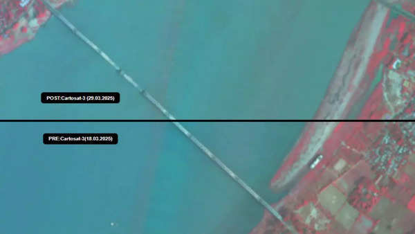
Source: ISRO
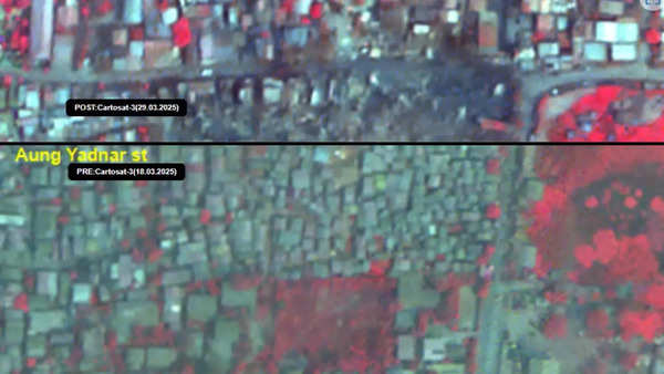
Source: ISRO
Devastation in Mandalay as Myanmar earthquake toll rises
The destruction power of the earthquake destroyed humongous loss in its path. According to the latest news, the official death toll has surpassed 1,700, with over 2,900 dead in the region. The death toll keeps increasing as rescue efforts are in progress.
- Mandalay: This epicenter city was also largely impacted. Some of its highlights, including the Ava Bridge and Mahamuni Pagoda, were lost to the devastation, which is a painful loss to the city and country.
- Sagaing region: Outlying communities like Sagaing were also severely hit. The scale of destruction has left thousands of individuals displaced, and relief efforts are still underway.
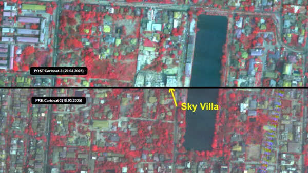
Source: ISRO
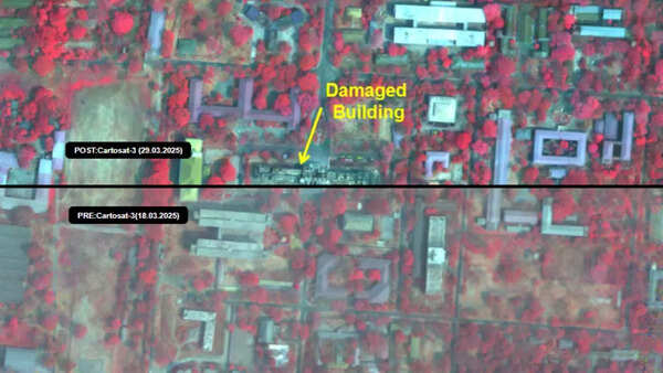
Source: ISRO
Myanmar Earthquake: India and global partners offer rescue support after devastation
Several nations, both neighboring countries of Myanmar and others beyond the region, offered assistance to facilitate rescue and relief efforts following the disaster. Thailand, too, though hit by the earthquake, soon initiated emergency relief initiatives. Myanmar’s military regime, however, declared an emergency to ensure coordination and carry out recovery efforts.
India relief assistance: India was one of the first nations to provide relief aid. Rescue personnel were sent to help in relief efforts in Myanmar, and relief efforts now involve searching for survivors and giving medical and logistical aid.
Satellite data assessment: ISRO satellite imagery proves to be an important tool in the assessment of damage. They assist the government in locating the most affected places and ordering priority for the allocation of resources in the rescue and relief process.
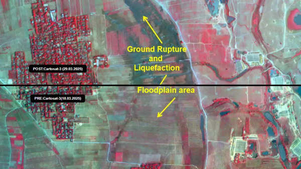
Source: ISRO
Myanmar earthquake: Search and recovery efforts underway
As the death toll climbs higher and the extent of the devastation is revealed, the citizens of Myanmar have a long way to go to rebuild what they lost. Search-and-rescue operations are the short-term concern, together with emergency health care and temporary accommodation for those made homeless by the earthquake. In the long term, labor will be involved in the reconstruction of lost infrastructure and icons such as the major transportation thoroughfares and national monuments.
The country has been put in mourning by the tragedy, but world sympathy and the resilience of the Myanmar people yield some measure of hope of ultimate recovery. Helped by satellite imagery in its continuing relief operation, by disaster response organizations, and from across the world, Myanmar will strive to rebuild its neighborhoods and recover from the disastrous fallout of the quake.
Also Read | ‘Best homecoming ever!’: Sunita Williams reunites with her dogs after space mission | Watch

